Geographical Regions
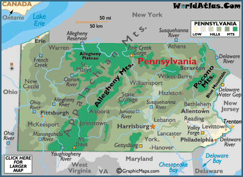
The Atlantic Coastal Plain is located in the southeastern Tip of PA along the Delaware River It is very narrow and flat coastal land. It was the first part of the state to be settled. It is the location of PA’s first industries and farms . The climate is the mildest in this part of the state. This allows the area to have a longer growing season.
The Piedmont region is between the coastal plain and the beginning of mountain land. Piedmont is French for "the foot of the mountains" It has many rolling hills and valleys and covers most of the southeastern part of the state. The area contains rich limestone soil for excellent farming and a large amount of iron ore. Many immigrants found this region to be second to none.
As you travel northwest, you will enter the Ridge and Valley region. This area is covered with mountain ridges and valleys. It includes about one third of the state and is madeup by the Appalachian Mountains. The region is great for farming.
As you travel west, the Allegheny Plateau covers more than one half of our state. It is the largest region. It is made up of rolling hills, valleys and streams. This region also contains the state's highest point, Mount Davis (3,213 feet above sea level) Iron ore, soft coal, oil and gas helped this part of the state to become a great industrial area. It also contains the center of the state's lumber industry.
The last region found to the extreme northwest is the Erie Plain. It extends a few miles inland along the shore of Lake Erie This region is very narrow and fertile. It has rich sandy soil and was once part of the lake bed. Today the region contains vineyards, orchards and farmland. It is also part of the snow belt.